

Electronic surveying instruments measure features, orientation and positioning of large-scale objects in engineering, construction, mapping, defense and other industries. Land surveying equipment assists with mapping, while construction surveying instruments are used to mark the position and layout of new structures. Electronic surveying instruments have made life easier for surveyors, who used to do their measurements using time-consuming conventional equipment such as chains, tapes, compasses and dumpy levels.
Distomat DI 1000
The Distomat is a very small, compact electronic distance measurement device, particularly useful in construction and engineering works. The Distomat measures distances smaller than 500 meters by simply pointing the instrument to a reflector and reading the result.
Geodimeter
The Geodimeter is often used for nighttime observations and can measure distances up to 3 kilometers. As this instrument measures distances based on the propagation of modulated light waves, it requires a prism system at the end of the distance you are measuring to reflect the waves.
Tellurometer
The Tellurometer is an electronic distance measurement device that uses high frequency radio waves or microwaves. This highly portable instrument works on 12 to 24 volt batteries and can be used day or night. Two Tellurometers are required to measure distances of up to 100 kilometers. A highly skilled person needs to be at each end of the surveyed area to take measurements. One Tellurometer is then used as the master, and the other as the remote unit.
Electronic Theodolite
The electronic Theodolite is a measurement unit that is used to determine horizontal and vertical angles in a certain area. The horizontal and vertical readings are displayed simultaneously on an LCD panel.
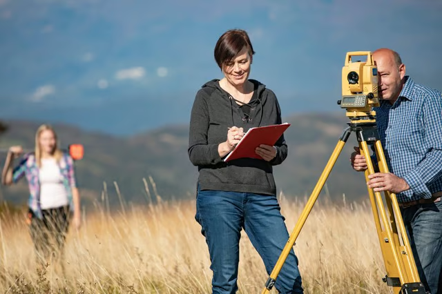
Total Station
A Total Station is a light-weight instrument, integrating the technology of an electronic or digital theodolite, an electronic distance measuring device and a microprocessor in the same unit. It is used for distance and angular measurement, data processing, digital display of point details and data storage in an electronic field book. The digital panel displays the distances, angles, heights and the coordinates of the observed area. A microprocessor applies corrections for the Earth’s curvature and refraction automatically.
Global Positioning System
The U.S. Defense Department developed the Global Positioning System, which is widely used for surveying purposes. Satellites transfer information about the specific location to a GPS receiver. A surveying GPS receiver will then process the signals received and calculate the latitude, longitude and elevation of the area. The main benefit of this system is that you no longer need a line of sight between two surveying points.
Automatic Level
Automatic levels are electronic surveying instruments that contain optical compensators. This self-leveling feature enables it to maintain a level line of sight even though the instrument is slightly tilted. After the bubble was manually centered, the automatic compensator takes over and levels the line of sight.